Tools
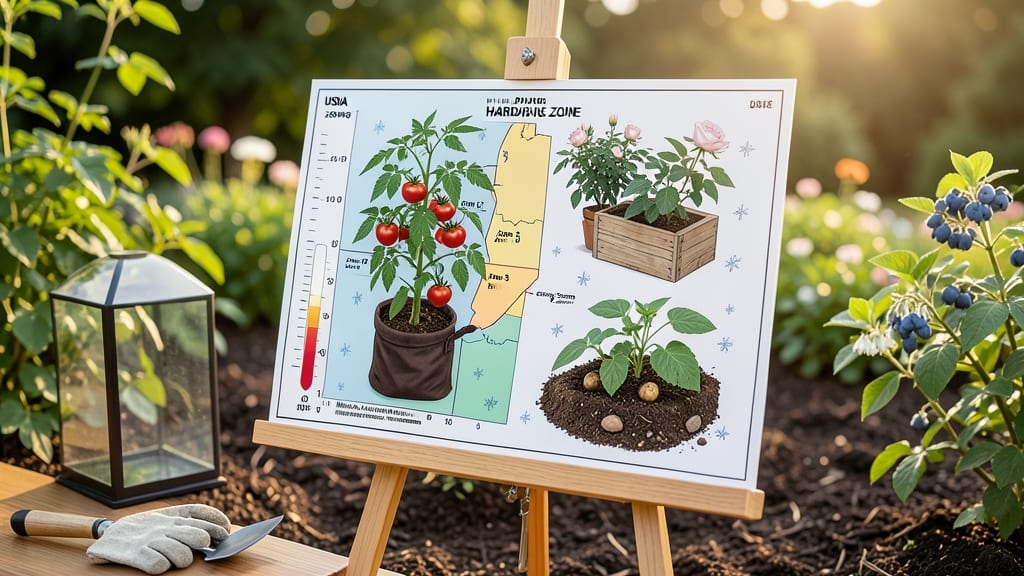
What do gardening zones mean? They determine which plants will survive winter in your area by classifying regions based on average minimum temperatures. These numbered zones (1-14) help gardeners choose cold-hardy species that match their local climate for reliable growth.
These climate-based classifications were developed by the USDA to standardize plant selection across North America. 🌱 The system analyzes 30-year temperature averages to create precise boundaries, ensuring gardeners can match plants to their region's coldest expected temperatures.
For example, a zone 5 plant can typically handle down to -20°F, while zone 9 plants need protection above 20°F—this difference explains why some varieties thrive in your yard but fail in a neighbor's just a few miles away.
What makes this system so valuable is how it accounts for regional variations while providing a universal reference. Many nurseries display zone information alongside plants, and online tools let you input your ZIP code to see your exact zone.
This prevents costly mistakes like planting tropical species in cold climates or freezing-sensitive plants in warm regions.
💡 In This Article
- How USDA Plant Hardiness Zones Are Determined
- Using Gardening Zones to Pick the Right Plants
How USDA plant hardiness zones are determined
The USDA Plant Hardiness Zone Map is based on 30-year averages of the lowest winter temperatures recorded in specific regions. Scientists analyze data from thousands of weather stations across North America to calculate these averages, which determine where a plant can survive without protection.
For example, zone 4 (with average lows of -30°F to -20°F) differs dramatically from zone 10 (30°F to 40°F), explaining why a peach tree thrives in Georgia but freezes solid in Minnesota.
Geographic factors like elevation and proximity to large bodies of water create variations even within the same zone. Coastal areas often experience milder winters due to ocean currents, while inland regions can be 5-10°F colder at night.
The USDA divides each zone into a and b subzones (e.g., 6a vs. 6b) to account for these microclimates, helping gardeners fine-tune their plant selections. For instance, a zone 6a plant (-10°F to -5°F) might struggle in a zone 6b area (-5°F to 0°F) if exposed to unexpected cold snaps.
Historical climate records reveal long-term patterns that matter more than short-term fluctuations. A single harsh winter doesn't reclassify a zone—scientists look at decades of data to account for natural variability. This precision ensures gardeners can reliably predict which plants will survive their local winters.
For example, while a zone 5 maple tree might survive -20°F, a zone 6 variety could fail in the same conditions, demonstrating why matching zones to plant hardiness is critical for success.
Plant hardiness isn't just about survival—it also affects growth vigor. Plants at the upper limit of their zone may grow slowly or produce fewer flowers, while those in ideal conditions thrive.
The USDA system accounts for this by testing thousands of species in controlled environments to determine their cold tolerance thresholds. This scientific approach prevents guesswork, ensuring gardeners can confidently select plants that will not only survive but also flourish in their specific climate conditions.
What most people don't realize is how these zones interact with other environmental factors. Soil type, sunlight exposure, and wind patterns can further influence plant performance within a zone.
For example, a zone 7 garden in a sheltered valley might support tropical plants that would fail in a windy, exposed location just miles away. Understanding these nuances helps gardeners create microclimates that expand their growing possibilities beyond the basic zone classification.
For practical application, gardeners can use the USDA Interactive Zone Finder to pinpoint their exact location. This tool overlays temperature data with geographic boundaries, providing precise zone information down to the ZIP code level.
By cross-referencing this data with plant tags (which often list hardiness zones), you can make informed decisions that maximize your garden's potential while avoiding costly mistakes.