Tools
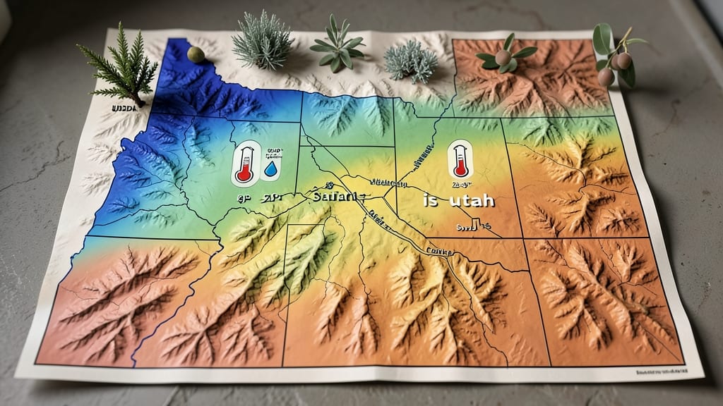
Utah's garden zones range from USDA Zone 3 in the northern mountains to Zone 8 in southern desert areas, with most of the state falling between Zones 5 and 7. Cache Valley's Zone 5 contrasts sharply with Washington County's Zone 8, creating dramatic planting variations across just 250 miles.
Understanding Utah's diverse USDA zones helps explain why your neighbor's garden thrives while yours struggles. 🌵 The state's dramatic elevation changes—from 1,300 feet in St. George to over 14,000 feet in the Uinta Mountains—create microclimates where frost dates can vary by 60 days between neighboring valleys.
For example, Box Elder County (Zone 5) might still see frost in May, while Washington County (Zone 8) could have 120+ frost-free days annually. This means a plant hardy in one county may fail completely just 50 miles away.
These variations aren't just academic—they directly impact what you can grow. Cold-hardy potatoes and apples thrive in northern Utah's Zone 5, while heat-loving citrus and olives find their niche in Zone 8's southern deserts.
The transition zones (5-7) offer the most flexibility, but even there, elevation shifts matter: a 1,000-foot climb can push you from Zone 6 to Zone 5 overnight. Always check your specific county's microclimate before planning your garden layout.
💡 In This Article
- How Utah’s Elevation Creates Unique USDA Zones
- Best Plants for Utah’s Mixed Garden Zones by County
How Utah’s elevation creates unique USDA zones
Utah’s dramatic elevation shifts—from near sea level in the southwest to over 14,000 feet in the Uinta Mountains—create one of the most extreme microclimate gradients in the U.S. The USDA Hardiness Zone Map accounts for these variations by measuring the average annual minimum temperature, which drops about 3.5°F per 1,000 feet in elevation.
This means a garden at 4,200 feet in Salt Lake City (Zone 6) could experience 10°F colder winters than one at 1,300 feet in St. George (Zone 8). The result? Frost-free seasons that vary by 60 days across just 250 miles of terrain.
The science behind this lies in atmospheric pressure and temperature inversion. Higher elevations have thinner air, which can’t retain heat as effectively, leading to cooler nights and earlier frosts.
For example, Cache Valley’s Zone 5 often sees frost until May 15, while Washington County’s Zone 8 might not experience frost until November 15.
This 6-month difference in growing seasons explains why cold-hardy crops like winter wheat thrive in northern Utah, while heat-loving fig trees flourish in southern deserts.
The USDA map simplifies these variations into zones, but local gardeners must adjust for specific microclimates—like urban heat islands in Salt Lake City or sheltered valleys in Kane County.
What most gardeners don’t realize is how elevation affects not just temperature but also precipitation patterns. Higher elevations receive more snowfall, which melts slowly and provides moisture for spring planting, while lower desert areas rely on summer monsoons.
This creates a paradox: Zone 5 areas might have longer growing seasons due to snowmelt watering the soil, while Zone 8 deserts face water scarcity despite warmer temperatures. The key takeaway?
Always verify your exact elevation and local frost dates—even within the same county, a 1,000-foot difference can push you from Zone 6 to Zone 5.
For practical application, consider how these zones influence planting timelines. In Zone 5, gardeners plant cool-season crops like spinach in early March, while Zone 8 gardeners might start tomatoes in February to avoid summer heat stress.
The transition zones (5-7) offer flexibility, but elevation-driven microclimates mean even neighboring gardens may have different optimal planting windows.
For instance, Ogden (Zone 6) might see its last frost on May 10, while Park City (Zone 5), just 30 miles away, could experience frost until June 1. 🌡️
Understanding these patterns helps explain why some plants thrive in one area but fail in another. For example, apples require 500-1,000 chill hours (below 45°F) to fruit properly—abundant in Zone 5 but scarce in Zone 8, where citrus trees take their place.
The USDA map provides a baseline, but Utah’s topography demands local adjustments. Always check your specific elevation and consult county extension offices for hyper-local advice—because in Utah, the difference between success and failure in your garden might be just a 500-foot climb up a mountain.